
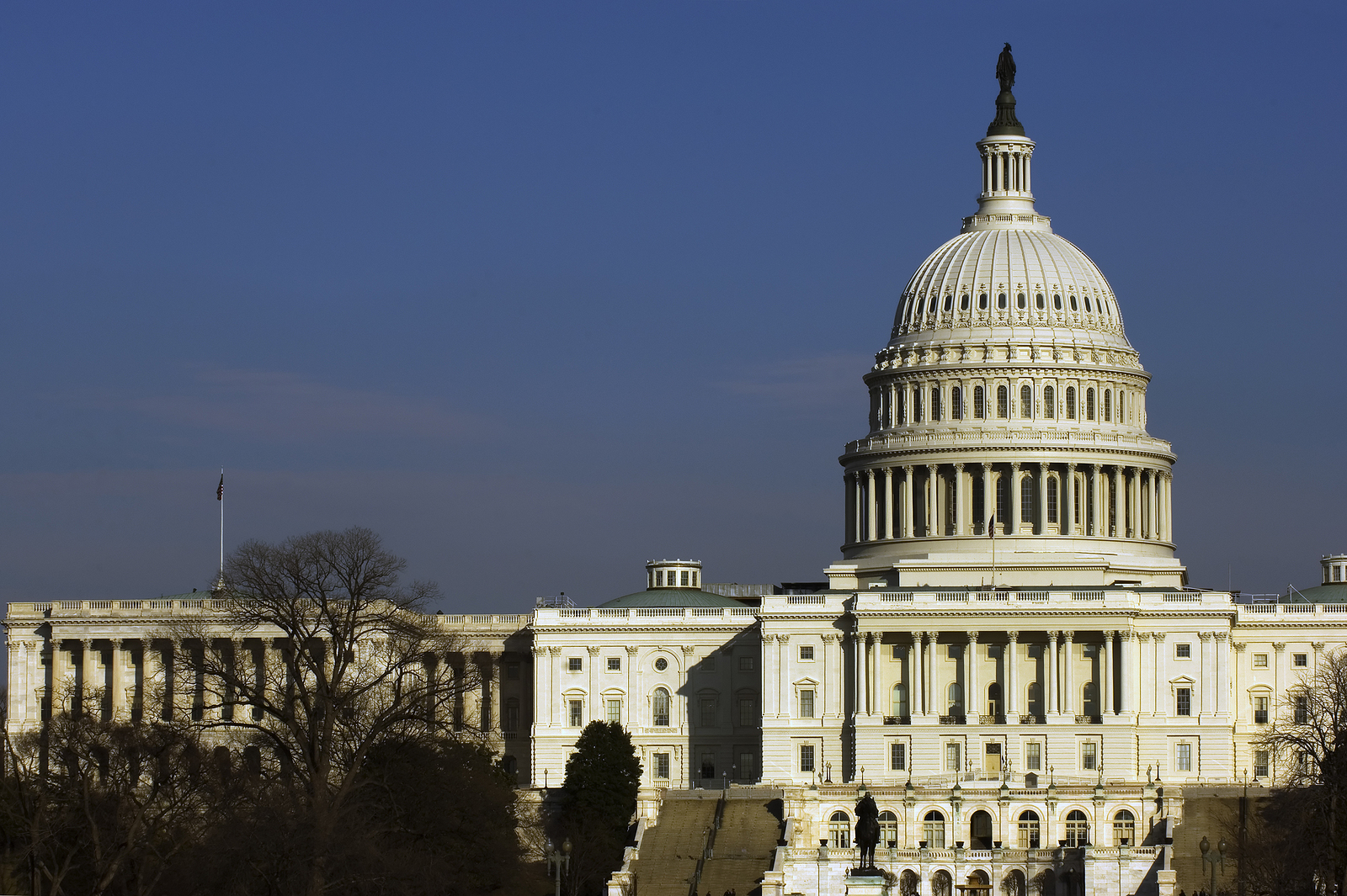
When most people imagine Washington, DC, they picture the White House, the U.S. Capitol, the National Mall, and the monuments that define the American capital. The city seems inseparable from the federal government, with its grand avenues, impressive architecture, and carefully planned public spaces. But what was Washington, DC before it became the nation’s capital?
Long before the first cornerstone of the White House was laid, the land along the Potomac and Anacostia rivers was home to Indigenous communities, colonial trading settlements, tobacco plantations, and busy commercial ports.
In fact, when George Washington selected the location for the nation’s permanent capital in 1791, he wasn’t choosing an empty wilderness. He was selecting a landscape with centuries of history, established communities, valuable trade routes, and an economy deeply connected to enslaved labor.
Understanding this earlier history reveals an entirely different side of Washington, one that visitors can still discover in the city’s oldest neighborhoods and historic landmarks.
Before Washington, DC: The Indigenous Communities of the Potomac
Thousands of years before European settlement, Indigenous peoples lived throughout the Potomac River watershed. The area’s rivers, forests, wetlands, and fertile land provided resources for fishing, hunting, farming, gathering, and trade.
Among the Indigenous communities associated with the region were the Nacotchtank, an Algonquian-speaking people whose settlements were concentrated near the eastern banks of what is now the Anacostia River. The Nacotchtank were part of a broader network of Indigenous communities connected through trade, cultural relationships, and shared resources. Their lives were closely tied to the rivers. Waterways served as transportation routes, sources of food, and connections between settlements.
Where Did the Name Anacostia Come From?
The name Anacostia is derived from Nacotchtank, preserving a connection to the area’s Indigenous history. When English explorer John Smith traveled through the Chesapeake Bay region in 1608, Indigenous communities were already well established along these waterways. European colonization subsequently brought disease, displacement, conflict, and major disruptions to Indigenous communities.
However, Indigenous history in the Washington region did not end with European settlement. Descendant communities, including the Piscataway, continue to preserve and share their cultural heritage today.
Historical connection: The National Park Service documents the Nacotchtank’s history and their relationship with the Anacostia River. Visitors interested in this earlier period can begin with the history of Anacostia Park.
The Potomac River: Why People Settled Here Long Before Washington
To understand why the nation’s capital developed where it did, it’s important to understand the Potomac River. Before railroads, highways, and commercial aviation, rivers were essential transportation corridors. The Potomac connected inland communities with the Chesapeake Bay and the Atlantic Ocean, making it valuable for trade and communication. Its navigable waters encouraged the growth of settlements where merchants could collect agricultural products, load ships, and exchange goods. The river also helped determine where towns developed. Near present-day Georgetown, the Potomac approaches a natural fall line where rapids and changes in elevation historically limited navigation by larger vessels. This geographic feature helped make the area an important transfer point for goods moving between inland communities and Atlantic trade routes.
What Did the Washington Area Look Like in the 1600s?
Instead of government buildings and broad ceremonial avenues, the landscape included:
- Indigenous settlements and established trading networks
- Forests and agricultural clearings
- Rivers, streams, marshes, and wetlands
- Early European trading posts and colonial farms
- Waterways used to transport people and goods
The region was not one unified city. It consisted of communities and settlements that developed at different times and for different purposes.
Georgetown: A Town Older Than Washington, DC
One of the most surprising facts about Washington is that Georgetown existed decades before the federal capital. Georgetown was established in 1751, nearly 40 years before Congress passed the Residence Act selecting the Potomac region for the nation’s permanent seat of government. At the time, Georgetown was part of colonial Maryland. Its waterfront location made it a valuable commercial center, particularly for the tobacco trade. Farmers and merchants transported tobacco from surrounding plantations to Georgetown, where it could be inspected, stored, and shipped to other markets. Warehouses, taverns, shops, and residences developed around the waterfront.
Georgetown Was a Working Port, Not an Elegant Shopping District
Today, Georgetown is known for upscale shopping, historic townhouses, restaurants, and picturesque streets. In the 18th century, however, it was a busy commercial settlement. The waterfront was lined with the infrastructure of trade, while merchants, craftspeople, laborers, and enslaved people supported the town’s economy. Its streets were shaped by commerce and daily life rather than the grand urban plan later created for the federal capital. This distinction explains why Georgetown looks and feels different from much of central Washington. Its narrower streets, irregular patterns, and surviving colonial-era architecture reflect a town that developed before the capital’s formal design.
The Old Stone House: A Building That Predates the United States
One of Georgetown’s most remarkable historic landmarks is the Old Stone House at 3051 M Street NW. Built in 1765, the house is the oldest surviving structure on its original foundation in Washington, DC. That means the building was already standing before the Declaration of Independence was signed in 1776.
The Old Stone House offers visitors a rare physical connection to the colonial settlement that existed before Washington became the nation’s capital. Interestingly, the building’s preservation was partly influenced by a historical misunderstanding.
For years, it was incorrectly associated with a visit by George Washington. The actual location connected with that visit was Suter’s Tavern, a different Georgetown establishment.
Despite the confusion, the Old Stone House survived and became an important example of the city’s pre-Revolutionary architecture.
Visit today: The Old Stone House is managed by the National Park Service. Check current visiting information, as interior access may be limited.
Alexandria: Another Colonial Town That Predated the Capital
Across the Potomac River in present-day Virginia, Alexandria was also developing as an important commercial center. Founded in 1749, Alexandria grew around its waterfront and became a significant port for agricultural products and Atlantic commerce. Like Georgetown, Alexandria’s economy was connected to the tobacco trade and the labor of enslaved people. Its location made it particularly attractive to merchants and landowners.
When the original federal district was established, Alexandria was included within its boundaries. The Virginia portion of the District of Columbia was later returned to Virginia in 1847, following federal legislation passed in 1846.
Today, Old Town Alexandria retains a distinctive historic character, with preserved streets, architecture, and waterfront spaces that reflect its colonial origins.
Why Alexandria and Georgetown Mattered to George Washington
George Washington recognized the commercial potential of the Potomac River. The existence of Georgetown and Alexandria demonstrated that the region already supported trade, transportation, and established settlements. Rather than creating a capital in complete isolation, the federal government could develop a new city near existing commercial centers. Washington also had a personal connection to the region through his Mount Vernon estate, located along the Potomac south of Alexandria. The river’s economic potential and the area’s geographic position helped make it attractive for the new federal capital.
The Forgotten Farms, Plantations, and Estates Beneath Modern Washington
Before the federal city was designed, much of the land that became central Washington consisted of privately owned farms, plantations, and estates. The landscape included agricultural fields, wooded areas, streams, and scattered buildings. Landowners cultivated crops and raised livestock, while some properties relied heavily on enslaved labor. Tobacco was an important regional cash crop, although agricultural practices evolved over time. The land that would eventually become the National Mall, Capitol Hill, and surrounding neighborhoods was divided among different owners. Creating a new federal city required surveying property, negotiating land arrangements, establishing streets, and transforming agricultural land into a planned urban landscape.
What Was Capitol Hill Before the Capitol?
Before the U.S. Capitol was constructed, the elevated site selected for the building was commonly known as Jenkins Hill. Its prominent position made it an attractive location for a major public building. Pierre Charles L’Enfant, the engineer responsible for designing the new capital, recognized the hill’s potential as a visual and symbolic focal point. Today, the U.S. Capitol dominates the landscape, but the site’s significance began with its natural geography.
What Was the National Mall Before It Existed?
The National Mall was not originally the open, landscaped public space visitors recognize today. Before the federal city’s development, the area included low-lying land, fields, streams, and privately held properties. L’Enfant’s 1791 plan envisioned a grand public avenue extending westward from the Capitol. The modern Mall evolved through later planning, construction, and landscape changes, including major redesign efforts in the early 20th century. The National Mall visitors see today is therefore the result of more than two centuries of development.
Slavery and the Economy of the Future Capital
Any accurate history of Washington before 1790 must acknowledge the role of slavery in the region. Maryland and Virginia were slaveholding colonies, and enslaved African Americans worked throughout the Potomac region. Their labor supported plantations, agriculture, households, transportation, construction, and commercial enterprises. Georgetown and Alexandria were connected to economic systems that depended on enslaved labor. After the federal district was established, enslaved workers also contributed to the construction of Washington’s public buildings and infrastructure. The White House, Capitol, and other early federal projects were built in part through the labor of enslaved African Americans.
This history complicates the familiar image of Washington as a city founded solely on ideals of liberty and representative government. The nation’s new capital emerged within a society in which freedom and slavery existed side by side.
Visitors interested in this history can explore resources from the White House Historical Association and the Smithsonian’s National Museum of African American History and Culture.
Why Did the United States Need a New Capital?
After the American Revolution, the United States did not immediately establish Washington as its permanent capital. Instead, the national government met in several locations, including Philadelphia and New York City.
The Constitution provided for a federal district that would serve as the permanent seat of government. The idea was that the national government should operate from a district under federal authority rather than remain dependent on an individual state. However, selecting the location proved politically difficult. Different states and regions wanted the economic advantages, prestige, and political influence associated with hosting the federal government. Northern and Southern leaders disagreed over where the capital should be located.
The debate eventually became connected to another major question facing the young nation: how the federal government would handle debts accumulated by individual states during the Revolutionary War.
The Compromise of 1790: The Deal That Brought the Capital to the Potomac
The location of Washington, DC was shaped by one of the early republic’s most consequential political compromises. Treasury Secretary Alexander Hamilton supported a plan for the federal government to assume certain state debts. James Madison and other political leaders raised objections to aspects of the proposal.
A compromise emerged that helped advance Hamilton’s financial program while securing support for a permanent capital along the Potomac River. The arrangement is commonly associated with discussions involving Hamilton, Madison, and Thomas Jefferson. On July 16, 1790, Congress passed the Residence Act, authorizing the establishment of the permanent federal capital along the Potomac. The legislation also provided for Philadelphia to serve as the temporary national capital while the new city was developed. The decision set in motion the transformation of the Potomac region into the seat of the federal government.
For visitors interested in the original legislation, the Library of Congress provides a collection of Residence Act primary documents.
Why Was George Washington Allowed to Choose the Capital’s Location?
The Residence Act gave President George Washington authority to select the precise location of the new federal district within the designated Potomac region. Washington favored the area near Georgetown and Alexandria, recognizing its commercial possibilities and strategic location. The original federal district included land contributed by Maryland and Virginia. The selected territory encompassed existing communities, rural properties, and the site of the new federal city. Washington’s role went beyond choosing the general location. He supervised important aspects of the planning process, appointed commissioners, and selected individuals responsible for surveying and designing the district. His decisions helped establish the geographic foundation of the modern capital.
Pierre L’Enfant and the Transformation of the Landscape
Once the location had been selected, the next challenge was designing a city that could serve as the permanent seat of the United States government.
George Washington appointed Pierre Charles L’Enfant, a French-born engineer who had served during the American Revolution, to develop the plan.
L’Enfant envisioned a city with broad avenues, public squares, prominent government buildings, and carefully arranged sightlines.
His design combined a regular street grid with diagonal avenues that connected important civic spaces.
Why Does Washington Have So Many Diagonal Streets?
Many American cities developed around relatively simple street grids. Washington’s layout is different because L’Enfant incorporated diagonal avenues into the underlying grid. These avenues created visual connections between important locations and helped establish the city’s distinctive circles, squares, and intersections. Pennsylvania Avenue, for example, became a prominent connection between the Capitol and the President’s House. The arrangement reflected L’Enfant’s ambition to create a capital worthy of the new nation.
Benjamin Banneker’s Role in Surveying the Capital
Benjamin Banneker, a free Black mathematician and astronomer, participated in the early surveying of the federal district. He assisted Andrew Ellicott, who was responsible for surveying the district’s boundaries. Banneker’s involvement is an important part of Washington’s founding history, particularly because free Black Americans faced substantial discrimination and legal restrictions during this period. His contribution should be distinguished from the work of L’Enfant, who developed the city’s original urban plan.
Banneker’s participation demonstrates that the creation of Washington involved a broader group of individuals than the most familiar founding figures.
Washington, DC Didn’t Become the Working Capital Overnight
Although the Residence Act passed in 1790 and planning began in 1791, the federal government did not immediately relocate to Washington. For approximately a decade, construction crews worked to establish the essential buildings and infrastructure.
The process was complicated by funding difficulties, labor shortages, disagreements over planning, and the enormous challenge of creating a new city. When the federal government moved to Washington in 1800, the city was still very much under construction. The Capitol was incomplete, roads were unfinished, and much of the surrounding landscape remained sparsely developed. Washington’s transformation into the monumental capital familiar today took generations.
Timeline: Washington Before It Became the Capital
| Year | Historical Milestone |
|---|---|
| Before European colonization | Indigenous communities inhabit and use the Potomac and Anacostia river regions |
| 1608 | John Smith explores the Chesapeake and Potomac waterways |
| 1749 | Alexandria is established in colonial Virginia |
| 1751 | Georgetown is established in colonial Maryland |
| 1765 | The Old Stone House is built in Georgetown |
| 1776 | The American colonies declare independence |
| 1787 | The U.S. Constitution provides for a permanent federal district |
| 1790 | The Residence Act selects the Potomac region for the future capital |
| 1791 | George Washington selects the district’s location and L’Enfant develops his city plan |
| 1800 | The federal government relocates to Washington |
5 Places Where You Can Still Explore Washington’s Pre-Capital History
Although much of the original landscape has changed, several destinations offer meaningful connections to the area’s history before 1790.
1. Georgetown Historic District
Georgetown is one of the most rewarding places to explore Washington’s pre-capital history. Its street patterns, historic buildings, and waterfront setting reveal the character of a town that existed before the federal city. A guided walking or driving tour can help connect surviving landmarks to the area’s colonial commercial history.
2. Old Stone House
Best for: Pre-Revolutionary architecture
Built in 1765, the Old Stone House provides a tangible connection to colonial Georgetown. Its survival offers visitors an opportunity to imagine the town before the American Revolution.
3. Old Town Alexandria
Across the Potomac, Old Town Alexandria preserves historic streets and buildings associated with the region’s commercial development. Its waterfront provides an opportunity to explore the importance of river transportation and trade.
4. Anacostia River and Anacostia Park
Best for: Indigenous history and early geography
The Anacostia River is closely connected to the history of the Nacotchtank people. Exploring the river’s geography provides important context for understanding why Indigenous communities established settlements in the area long before the creation of Washington.
5. Capitol Hill
Although the Capitol itself was constructed after the federal district was established, the site’s elevation and position help visitors understand why L’Enfant selected it as the centerpiece of his plan.
Standing near the Capitol offers a chance to imagine the landscape before the government buildings, ceremonial avenues, and surrounding neighborhoods developed.
Explore the History Behind Washington, DC With Tiber Creek Private Tours
Washington’s most famous monuments tell the story of the United States after its founding. But the land beneath those monuments has a history stretching back centuries. From the Indigenous communities of the Potomac and Anacostia rivers to colonial Georgetown, the commercial ports of the 18th century, and the political decisions that created the federal district, Washington’s early history is far richer than many visitors realize.
At Tiber Creek Private Tours, we help visitors discover the stories behind the nation’s capital through personalized sightseeing experiences.
Whether you’re interested in colonial history, presidential landmarks, architecture, African American history, or the evolution of Washington’s neighborhoods, a customized private tour can bring these stories together. Explore the city beyond its most recognizable monuments and discover how the Washington of today emerged from the communities and landscapes that came before it.
Ready to experience Washington’s history in a new way? Contact Tiber Creek Private Tours to plan a personalized Washington, DC historical sightseeing experience.